


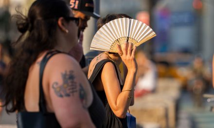


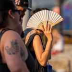
The scorching heat is expected to continue throughout the weekend
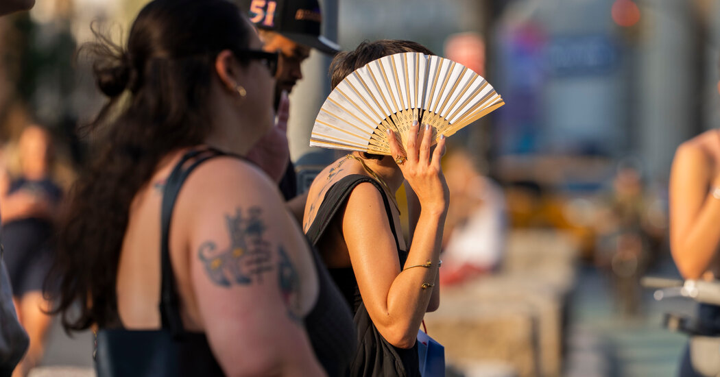
A dangerous, prolonged heat wave that has brought triple-digit temperatures across much of the central and eastern United States was expected to last Friday and into the weekend. Typical warm summer weather is not expected to return until Monday across much of the Northeast and Mid-Atlantic.
Around 180 million people were under an extreme heat warning or heat warning on Friday, and many had already been under strict warnings against going outdoors during the hottest part of the day for several days. Forecasters expect some of the highest temperatures around Philadelphia, which could reach 104. New York was poised to reach 101 and Washington 103.
But the sweaty forecasts only tell part of the story.
On Friday, a Salute to Independence Semiquincentennial Parade in Philadelphia marking the 250th birthday of the United States was canceled, with event organizers citing “extreme heat” in social media posts. In the nation’s capital, organizers of the Great American State Fair postponed all daytime activities until 5 p.m. Eastern Time, citing the heat in a social media post.
This followed conditions on Thursday when the heat shut down rail service along the Northeast Corridor. Even the New England coast, a premier vacation destination known for both its relatively temperate summers and its seafood, slowed under the weight of humidity as guests retreated to the comfort of air conditioning.
The heat also strained power grids, causing scattered outages in New Jersey, New York and Ohio for tens of thousands of utility customers on Thursday, according to tracking website PowerOutage.us.
More records are expected in the coming days. The National Weather Service expects more than 100 daily maximum records to be broken by Sunday.
Important things to know about the heatwave
-
On Thursday, Central Park reached 100 degrees for the first time since 2012, while Philadelphia reached 103, tying its 1901 record.
-
Conditions are worsened by high humidity, resulting in oppressive heat index values. This index is a measure of how hot it actually feels outside.
-
Temperatures only dipping into the low 80s or high 70s offer little relief, and forecasters warned of heat-related illnesses. Heat is the leading cause of weather-related deaths in the United States. Here’s what it does to your body, and here are tips on how to stay cool.
-
While linking a single heat wave to climate change requires analysis, scientists have no doubt that heat waves around the world are becoming hotter, more frequent and longer-lasting.
The current forecast
Friday
“Dangerous, record-breaking heat” is expected to continue Friday in an area between Illinois, Maine and Georgia, the weather service said. Similar temperatures to Thursday were forecast, with afternoon highs in the mid 90s to low 100s. The heat index could reach 115 degrees.
By 11 a.m. Eastern time, the heat index across the region had already risen to over 100 degrees – in some cases well above. Washington had a temperature of 110°C and an actual temperature of 97°C; Harrisburg, Pennsylvania was at 105° with an actual temperature of 96°; and in Richmond, Virginia, the index reached 104 with an actual temperature of 92.
Saturday
The Fourth of July might bring some relief, but only a small one. The greatest cooling was expected in the Great Lakes and northern New England, with temperatures likely to fall into the 80s.
Parts of the Northeast are likely to cool slightly, with Philadelphia, New York City and Boston expected to drop a few degrees below Friday’s level. But in general, it was forecast to remain hot everywhere from Massachusetts to the Carolinas, with afternoon highs in the 90s to low 100s.
A score of 99 was forecast for New York City and a score of 100 for Philadelphia on Independence Day.
Brief rain and thunderstorms over the Mid-Atlantic and near Ohio could lower temperatures.
“The showers will be mostly isolated,” said Frank Pereira, a meteorologist with the Weather Prediction Center. “Where they occur there will be temporary cooling, but once the sun comes out again it will warm up again.”
The worst of Saturday’s heat was expected in the Washington area, where a high of 102 was expected, and further south toward Raleigh, North Carolina, where the high could reach 105.
Sunday
Temperatures were expected to fall more generally on Sunday, with rain and thunderstorms still possible, particularly across much of the Mid-Atlantic.
Afternoon highs in the 80s were likely across much of the Northeast and New England, but the heat will continue across the southern part of the Mid-Atlantic and into the Southeast.
Temperatures in the 90s are forecast for the area from Philadelphia to Washington, and triple-digit heat was expected in the Carolinas.
“The worst will come from Atlanta to North Carolina,” said Marc Chenard, a meteorologist with the Weather Prediction Center.
How to prevent heat-related illnesses
To stay safe during a heat wave, prevention is crucial. Drink water throughout the day and before you feel thirsty, and avoid being outdoors during the hottest part of the day, generally from late morning to late afternoon.
It’s important to recognize the warning signs of extreme heat exposure, and one of the earliest signs is heat edema, or swelling in the ankles, hands and feet, Dr. Christopher Bazzoli, an emergency physician at the Cleveland Clinic. Mild, early symptoms can develop into full-blown heat stroke.
If you notice this type of swelling, move to the coolest place possible – ideally an air-conditioned place. If you must stay outside, find some shade. Elevating your feet can also help reduce the swelling.
Symptoms of heat exhaustion, a moderate form of heat-related illness, can include nausea, fainting or dizziness, muscle cramps, and a racing heartbeat. If you experience any of these symptoms, move to a cool place, rest, and drink fluids.
A more serious form of heat illness is heat stroke, which can be fatal. People who suffer heat stroke may develop a high body temperature (at or above 103 degrees) and hot and red skin that is either dry or moist. Symptoms also include headaches, dizziness, nausea and a racing heart.
When is the heat wave coming?
Not for a few days. By Monday, a return to typical warm summer weather was expected from the Great Lakes to the Northeast, with extended afternoon high temperatures in the 80s.
A score of 81 was forecast for New York City and 83 for Philadelphia on Monday.
However, in some areas, particularly in the Carolinas, air conditioning may still be turned up.
“Next week will be better for most people but the south east will remain warm and humid but nothing record breaking,” Mr Chenard said.
Reporting was contributed by Minho Kim, Claire Fahy, Jenna Russell, Dani Blum, Erin McCann and Nazaneen Ghaffar.


